Bull kelp surface extent at select sites in the Southern Gulf Islands, 2010-2024
These data contain a record of surface extent of bull kelp at select sites in the Southern Gulf Islands. All of the 2010-2018 data were recorded in the nearshore waters of Mayne Island. Starting in 2019 the monitoring program was expanded in collaboration with the Galiano Conservancy Association, Pender Islands Conservancy Association, Saturna Island Marine Research and Education Society, and Valdes Island Conservancy to include additional sites around those islands. We anticipate annual monitoring of select sites will continue on an annual basis.
Simple
- Date (Publication)
- 2024-04-17
- Cited responsible party
-
Organisation name Individual name Electronic mail address Role Mayne Island Conservancy Society
Rob Underhill
Point of contact
- Purpose
-
These data are being collected to inform land use planning, marine stewardship, and detect long-term trends in bull kelp extent.
- Credit
-
Mayne Island Conservancy Society
- Status
- ongoing
- Point of contact
-
Organisation name Individual name Electronic mail address Role Mayne Island Conservancy Society
Rob Underhill
Point of contact
- Maintenance and update frequency
- Annually
-
Government of Canada Core Subject Thesaurus
-
-
Aquatic plants
-
Ecology
-
Marine biology
-
Aquatic ecosystems
-
Coastal waters
-
Oceans
-
Salt water
-
- Use limitation
-
Provide credit to Mayne Island Conservancy Society. Consider collaboration.
- Spatial representation type
- Vector
- Language
-
English
- Character set
- UTF8
- Topic category
-
- Biota
- Oceans
))
- Distribution format
-
Name Version Dataset
1
- Distributor contact
-
Organisation name Individual name Electronic mail address Role Pacific Salmon Foundation
Distributor
- OnLine resource
- OnLine resource
-
Protocol Linkage Name DOI
https://doi.org/10.48689/1e92e7a8-b7d6-47bc-ad97-18887397108b Digital Object Identifier (DOI)
- Hierarchy level
- Dataset
- Description
-
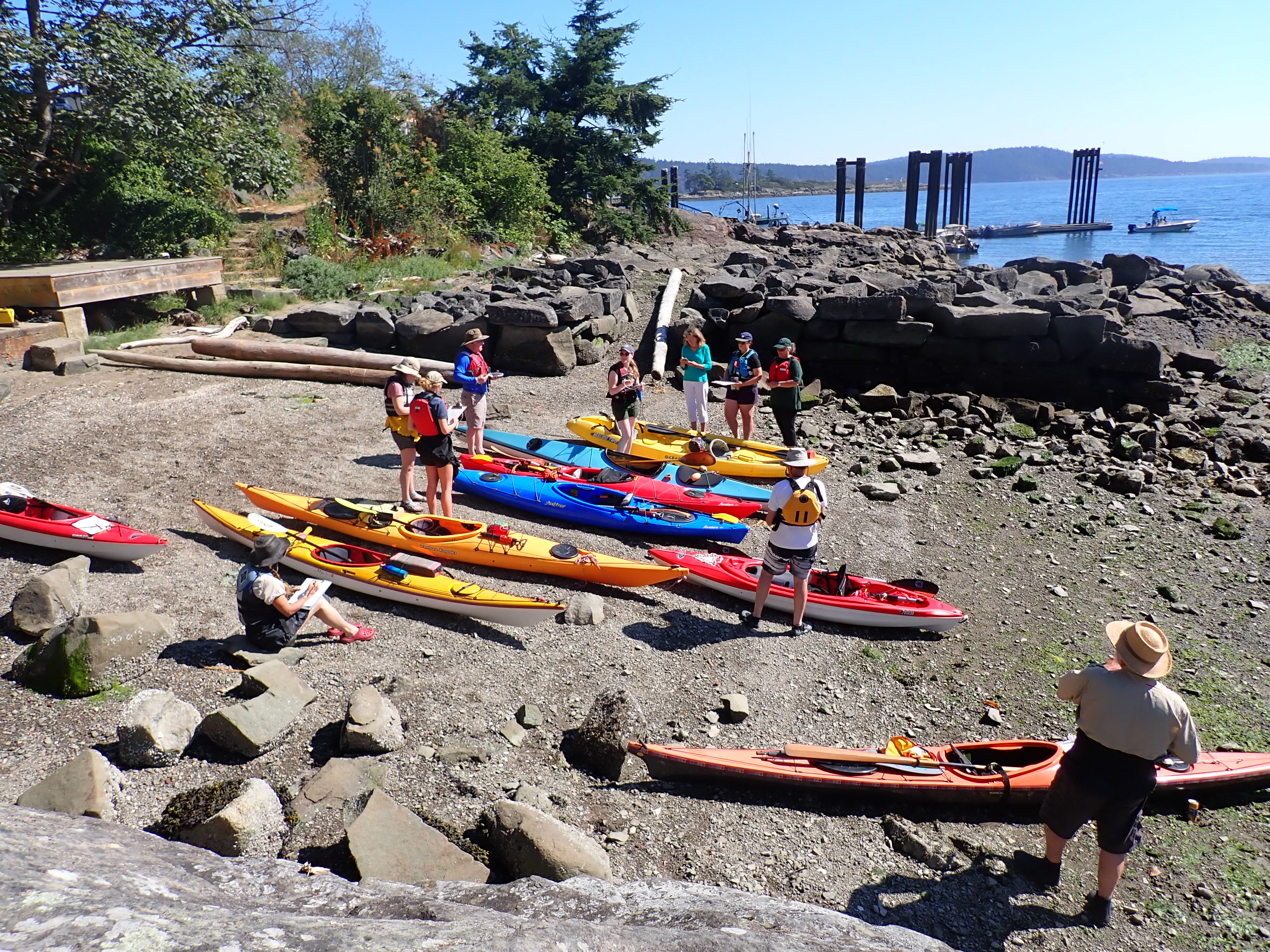
Data was acquired each year between August 1st and September 15th. Data was recorded by surveyors in kayaks using a variety of handheld GPS devices. Most commonly GPSmap 60 or 62. Prior to survey each year surveyors attend a calibration and training day where each surveyor covers the same area to ensure consistency in data collection.
- Processor
-
Organisation name Individual name Electronic mail address Role Mayne Island Conservancy Society
Rob Underhill
Point of contact
- Description
-
Staff from the Mayne Island Conservancy compile and interpret all data collected by regional collaborators under the supervision of Rob Underhill RPBio
- Processor
-
Organisation name Individual name Electronic mail address Role Mayne Island Conservancy Society
Rob Underhill
Point of contact
Metadata
- File identifier
- 1e92e7a8-b7d6-47bc-ad97-18887397108b XML
- Metadata language
-
eng; CAN
- Character set
- UTF8
- Hierarchy level
- Dataset
- Date stamp
- 2024-12-20T00:27:56.988Z
- Metadata standard name
-
North American Profile of ISO 19115:2003 - Geographic information - Metadata
- Metadata standard version
-
NAP - CAN/CGSB-171.100-2009
- Metadata author
-
Organisation name Individual name Electronic mail address Role Mayne Island Conservancy Society
Rob Underhill
Point of contact
Overviews
Spatial extent
Provided by